

The PAMCET Learning Team is the institutional curriculum and content group behind course publishing on this platform. PAMCET (Professional and Academic Management Centre for Education and Training) is operated by Digitpen Hub Ltd, a company registered in Lagos, Nigeria. Courses credited to the PAMCET Learning Team are structured, organized, and published centrally by the platform rather than authored by a single named individual instructor — each course's syllabus, learning outcomes, and content are reviewed before publication under this institutional account. For questions about a specific course or to report a content issue, please use the platform's Help & Support or Contact Us pages.
B.Eng DegreeFaculty of Faculty of Engineering & TechnologyCivil Engineering
CVE 214: Digital Surveying & Terrain Modeling (Total Station & GNSS)
Electronic Distance Measurement (EDM), digital total stations, Global Navigation Satellite Systems (GNSS/GPS), Real-Time Kinematic (RTK) surveying, Digital Elevation Models (DEM), and construction setting-out.

Course Overview
Electronic Distance Measurement (EDM), digital total stations, Global Navigation Satellite Systems (GNSS/GPS), Real-Time Kinematic (RTK) surveying, Digital Elevation Models (DEM), and construction setting-out. Curriculum Structure & Core Modules: • 1. Principles of Electronic...
What You'll Learn
- Operate electronic total stations for coordinate measurement (E, N, Z) and feature code data logging.
- Execute closed polygon theodolite traverse adjustments using Bowditch (compass) and transit rules.
- Deploy multi-frequency GNSS receivers in Real-Time Kinematic (RTK) mode for rapid topographic mapping.
- Generate Digital Elevation Models (DEM) and TIN surface meshes in civil engineering software.
- Perform construction setting-out calculations to stake building corners, pipe trenches, and road curves.
Requirements
- Pass in CVE 209 and CVE 213.
Degree Programme Curriculum Context
This course is a curriculum unit of the Bachelor of Engineering (B.Eng.) in Civil Engineering degree framework in Nigeria.
Earn Your Certificate
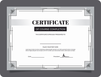
Showcase your skills with a certificate! Complete the course, submit your project, and earn your certificate. Here's a sample of what you'll receive to show off your accomplishments.
Lecture Board & Syllabus
Course Curriculum
Browse complete theoretical foundations, worked calculations, laboratory protocols, and board assessment questions under each topic.
8 Chapters
•16 Lecture
•24h
Subtopic 1Document LectureOpen Access~21 min read
Principles of Electronic Distance Measurement (EDM): Phase Shift and Pulse Time-of-Flight: Theoretical Foundations, Continuum Mechanics & Architecture
CVE 214 • 200L • Surveying & Geomatics Chapter 1 • Lecture 1 Chapter 1: Principles of Electronic Distance Measurement (EDM): Phase Shift and Pulse Time-of-Flight — Theoretical Foundations, Continuum Mechanics & Structural Architecture Curriculum Alignment: Digital Surveying & Terrain Modeling (Total Station & GNSS) • NUC-CCMAS-CVE-210 • COREN-CVE-SUR-03 • Eu...
Module 1 • Subtopic 1•17,661 characters of authentic academic content
Subtopic 2Document LectureOpen Access~33 min read
Principles of Electronic Distance Measurement (EDM): Phase Shift and Pulse Time-of-Flight: Applied Engineering Computation, Design & Verification
CVE 214 • 200L • Surveying & Geomatics Chapter 1 • Lecture 2 Chapter 1: Principles of Electronic Distance Measurement (EDM): Phase Shift and Pulse Time-of-Flight — Applied Engineering Computation, Design Verification & Protocols Applied Engineering Computations • Numerical Simulation Models • Laboratory Testing SOPs • FMEA Quality Risk Management 1. Applied...
Module 1 • Subtopic 2•27,254 characters of authentic academic content
Formative Assessment10 Points • 15 Mins
CVE 214 Ch 1 Assessment: Principles of Electronic Distance Measurement (EDM): Phase Shift and Pulse Time-of-Flight
Assessment Protocol:10 Total Points•70% Passing Threshold•15 Mins Time Limit•Bloom's Taxonomy: Analyze & Evaluate
Formative engineering mastery assessment for CVE 214 Chapter 1: Principles of Electronic Distance Measurement (EDM): Phase Shift and Pulse Time-of-Flight. Tests theoretical mechanisms, governing equations, and worked calculation procedures.
Module 1 • Formative Assessment
Subtopic 1Document LectureOpen Access~21 min read
Electronic Total Stations: Optical Components, Digital Compensators, and Data Collector Workflows: Theoretical Foundations, Continuum Mechanics & Architecture
CVE 214 • 200L • Surveying & Geomatics Chapter 2 • Lecture 1 Chapter 2: Electronic Total Stations: Optical Components, Digital Compensators, and Data Collector Workflows — Theoretical Foundations, Continuum Mechanics & Structural Architecture Curriculum Alignment: Digital Surveying & Terrain Modeling (Total Station & GNSS) • NUC-CCMAS-CVE-210 • COREN-CVE-SUR-03 &...
Module 2 • Subtopic 1•17,729 characters of authentic academic content
Subtopic 2Document LectureOpen Access~33 min read
Electronic Total Stations: Optical Components, Digital Compensators, and Data Collector Workflows: Applied Engineering Computation, Design & Verification
CVE 214 • 200L • Surveying & Geomatics Chapter 2 • Lecture 2 Chapter 2: Electronic Total Stations: Optical Components, Digital Compensators, and Data Collector Workflows — Applied Engineering Computation, Design Verification & Protocols Applied Engineering Computations • Numerical Simulation Models • Laboratory Testing SOPs • FMEA Quality Risk Management 1....
Module 2 • Subtopic 2•27,314 characters of authentic academic content
Formative Assessment10 Points • 15 Mins
CVE 214 Ch 2 Assessment: Electronic Total Stations: Optical Components, Digital Compensators, and Data Collector Workflows
Assessment Protocol:10 Total Points•70% Passing Threshold•15 Mins Time Limit•Bloom's Taxonomy: Analyze & Evaluate
Formative engineering mastery assessment for CVE 214 Chapter 2: Electronic Total Stations: Optical Components, Digital Compensators, and Data Collector Workflows. Tests theoretical mechanisms, governing equations, and worked calculation procedures.
Module 2 • Formative Assessment
Subtopic 1Document LectureOpen Access~21 min read
Total Station Traverse: Angle Balancing, Linear Misclosure, and Bowditch Coordinate Adjustment: Theoretical Foundations, Continuum Mechanics & Architecture
CVE 214 • 200L • Surveying & Geomatics Chapter 3 • Lecture 1 Chapter 3: Total Station Traverse: Angle Balancing, Linear Misclosure, and Bowditch Coordinate Adjustment — Theoretical Foundations, Continuum Mechanics & Structural Architecture Curriculum Alignment: Digital Surveying & Terrain Modeling (Total Station & GNSS) • NUC-CCMAS-CVE-210 • COREN-CVE-SUR-03 &bul...
Module 3 • Subtopic 1•17,711 characters of authentic academic content
Subtopic 2Document LectureOpen Access~33 min read
Total Station Traverse: Angle Balancing, Linear Misclosure, and Bowditch Coordinate Adjustment: Applied Engineering Computation, Design & Verification
CVE 214 • 200L • Surveying & Geomatics Chapter 3 • Lecture 2 Chapter 3: Total Station Traverse: Angle Balancing, Linear Misclosure, and Bowditch Coordinate Adjustment — Applied Engineering Computation, Design Verification & Protocols Applied Engineering Computations • Numerical Simulation Models • Laboratory Testing SOPs • FMEA Quality Risk Management 1. App...
Module 3 • Subtopic 2•27,299 characters of authentic academic content
Formative Assessment10 Points • 15 Mins
CVE 214 Ch 3 Assessment: Total Station Traverse: Angle Balancing, Linear Misclosure, and Bowditch Coordinate Adjustment
Assessment Protocol:10 Total Points•70% Passing Threshold•15 Mins Time Limit•Bloom's Taxonomy: Analyze & Evaluate
Formative engineering mastery assessment for CVE 214 Chapter 3: Total Station Traverse: Angle Balancing, Linear Misclosure, and Bowditch Coordinate Adjustment. Tests theoretical mechanisms, governing equations, and worked calculation procedures.
Module 3 • Formative Assessment
Subtopic 1Document LectureOpen Access~21 min read
Satellite Geodesy Fundamentals: Space, Control, and User Segments of GPS, GLONASS, and Galileo: Theoretical Foundations, Continuum Mechanics & Architecture
CVE 214 • 200L • Surveying & Geomatics Chapter 4 • Lecture 1 Chapter 4: Satellite Geodesy Fundamentals: Space, Control, and User Segments of GPS, GLONASS, and Galileo — Theoretical Foundations, Continuum Mechanics & Structural Architecture Curriculum Alignment: Digital Surveying & Terrain Modeling (Total Station & GNSS) • NUC-CCMAS-CVE-210 • COREN-CVE-SUR-03 &bul...
Module 4 • Subtopic 1•17,433 characters of authentic academic content
Subtopic 2Document LectureOpen Access~32 min read
Satellite Geodesy Fundamentals: Space, Control, and User Segments of GPS, GLONASS, and Galileo: Applied Engineering Computation, Design & Verification
CVE 214 • 200L • Surveying & Geomatics Chapter 4 • Lecture 2 Chapter 4: Satellite Geodesy Fundamentals: Space, Control, and User Segments of GPS, GLONASS, and Galileo — Applied Engineering Computation, Design Verification & Protocols Applied Engineering Computations • Numerical Simulation Models • Laboratory Testing SOPs • FMEA Quality Risk Management 1. App...
Module 4 • Subtopic 2•26,903 characters of authentic academic content
Formative Assessment10 Points • 15 Mins
CVE 214 Ch 4 Assessment: Satellite Geodesy Fundamentals: Space, Control, and User Segments of GPS, GLONASS, and Galileo
Assessment Protocol:10 Total Points•70% Passing Threshold•15 Mins Time Limit•Bloom's Taxonomy: Analyze & Evaluate
Formative engineering mastery assessment for CVE 214 Chapter 4: Satellite Geodesy Fundamentals: Space, Control, and User Segments of GPS, GLONASS, and Galileo. Tests theoretical mechanisms, governing equations, and worked calculation procedures.
Module 4 • Formative Assessment
Subtopic 1Document LectureOpen Access~21 min read
GNSS Positioning Techniques: Autonomous, DGPS, Static Carrier-Phase, and Real-Time Kinematic (RTK): Theoretical Foundations, Continuum Mechanics & Architecture
CVE 214 • 200L • Surveying & Geomatics Chapter 5 • Lecture 1 Chapter 5: GNSS Positioning Techniques: Autonomous, DGPS, Static Carrier-Phase, and Real-Time Kinematic (RTK) — Theoretical Foundations, Continuum Mechanics & Structural Architecture Curriculum Alignment: Digital Surveying & Terrain Modeling (Total Station & GNSS) • NUC-CCMAS-CVE-210 • COREN-CVE-SUR-03...
Module 5 • Subtopic 1•17,669 characters of authentic academic content
Subtopic 2Document LectureOpen Access~33 min read
GNSS Positioning Techniques: Autonomous, DGPS, Static Carrier-Phase, and Real-Time Kinematic (RTK): Applied Engineering Computation, Design & Verification
CVE 214 • 200L • Surveying & Geomatics Chapter 5 • Lecture 2 Chapter 5: GNSS Positioning Techniques: Autonomous, DGPS, Static Carrier-Phase, and Real-Time Kinematic (RTK) — Applied Engineering Computation, Design Verification & Protocols Applied Engineering Computations • Numerical Simulation Models • Laboratory Testing SOPs • FMEA Quality Risk Management 1....
Module 5 • Subtopic 2•27,253 characters of authentic academic content
Formative Assessment10 Points • 15 Mins
CVE 214 Ch 5 Assessment: GNSS Positioning Techniques: Autonomous, DGPS, Static Carrier-Phase, and Real-Time Kinematic (RTK)
Assessment Protocol:10 Total Points•70% Passing Threshold•15 Mins Time Limit•Bloom's Taxonomy: Analyze & Evaluate
Formative engineering mastery assessment for CVE 214 Chapter 5: GNSS Positioning Techniques: Autonomous, DGPS, Static Carrier-Phase, and Real-Time Kinematic (RTK). Tests theoretical mechanisms, governing equations, and worked calculation procedures.
Module 5 • Formative Assessment
Subtopic 1Document LectureOpen Access~21 min read
Topographic Data Ingestion: Point Clouds, Feature Codes, Breaklines, and TIN Surface Generation: Theoretical Foundations, Continuum Mechanics & Architecture
CVE 214 • 200L • Surveying & Geomatics Chapter 6 • Lecture 1 Chapter 6: Topographic Data Ingestion: Point Clouds, Feature Codes, Breaklines, and TIN Surface Generation — Theoretical Foundations, Continuum Mechanics & Structural Architecture Curriculum Alignment: Digital Surveying & Terrain Modeling (Total Station & GNSS) • NUC-CCMAS-CVE-210 • COREN-CVE-SUR-03 &bu...
Module 6 • Subtopic 1•17,346 characters of authentic academic content
Subtopic 2Document LectureOpen Access~32 min read
Topographic Data Ingestion: Point Clouds, Feature Codes, Breaklines, and TIN Surface Generation: Applied Engineering Computation, Design & Verification
CVE 214 • 200L • Surveying & Geomatics Chapter 6 • Lecture 2 Chapter 6: Topographic Data Ingestion: Point Clouds, Feature Codes, Breaklines, and TIN Surface Generation — Applied Engineering Computation, Design Verification & Protocols Applied Engineering Computations • Numerical Simulation Models • Laboratory Testing SOPs • FMEA Quality Risk Management 1. Ap...
Module 6 • Subtopic 2•27,078 characters of authentic academic content
Formative Assessment10 Points • 15 Mins
CVE 214 Ch 6 Assessment: Topographic Data Ingestion: Point Clouds, Feature Codes, Breaklines, and TIN Surface Generation
Assessment Protocol:10 Total Points•70% Passing Threshold•15 Mins Time Limit•Bloom's Taxonomy: Analyze & Evaluate
Formative engineering mastery assessment for CVE 214 Chapter 6: Topographic Data Ingestion: Point Clouds, Feature Codes, Breaklines, and TIN Surface Generation. Tests theoretical mechanisms, governing equations, and worked calculation procedures.
Module 6 • Formative Assessment
Subtopic 1Document LectureOpen Access~21 min read
Construction Setting-Out: Polar Stakeout, Offsets, Batter Boards, and Profile Grade Control: Theoretical Foundations, Continuum Mechanics & Architecture
CVE 214 • 200L • Surveying & Geomatics Chapter 7 • Lecture 1 Chapter 7: Construction Setting-Out: Polar Stakeout, Offsets, Batter Boards, and Profile Grade Control — Theoretical Foundations, Continuum Mechanics & Structural Architecture Curriculum Alignment: Digital Surveying & Terrain Modeling (Total Station & GNSS) • NUC-CCMAS-CVE-210 • COREN-CVE-SUR-03 •...
Module 7 • Subtopic 1•17,619 characters of authentic academic content
Subtopic 2Document LectureOpen Access~33 min read
Construction Setting-Out: Polar Stakeout, Offsets, Batter Boards, and Profile Grade Control: Applied Engineering Computation, Design & Verification
CVE 214 • 200L • Surveying & Geomatics Chapter 7 • Lecture 2 Chapter 7: Construction Setting-Out: Polar Stakeout, Offsets, Batter Boards, and Profile Grade Control — Applied Engineering Computation, Design Verification & Protocols Applied Engineering Computations • Numerical Simulation Models • Laboratory Testing SOPs • FMEA Quality Risk Management 1. Applie...
Module 7 • Subtopic 2•27,210 characters of authentic academic content
Formative Assessment10 Points • 15 Mins
CVE 214 Ch 7 Assessment: Construction Setting-Out: Polar Stakeout, Offsets, Batter Boards, and Profile Grade Control
Assessment Protocol:10 Total Points•70% Passing Threshold•15 Mins Time Limit•Bloom's Taxonomy: Analyze & Evaluate
Formative engineering mastery assessment for CVE 214 Chapter 7: Construction Setting-Out: Polar Stakeout, Offsets, Batter Boards, and Profile Grade Control. Tests theoretical mechanisms, governing equations, and worked calculation procedures.
Module 7 • Formative Assessment
Subtopic 1Document LectureOpen Access~21 min read
Introduction to Geographic Information Systems (GIS) and Geospatial Data Coordinate Transformations: Theoretical Foundations, Continuum Mechanics & Architecture
CVE 214 • 200L • Surveying & Geomatics Chapter 8 • Lecture 1 Chapter 8: Introduction to Geographic Information Systems (GIS) and Geospatial Data Coordinate Transformations — Theoretical Foundations, Continuum Mechanics & Structural Architecture Curriculum Alignment: Digital Surveying & Terrain Modeling (Total Station & GNSS) • NUC-CCMAS-CVE-210 • COREN-CVE-SUR-03...
Module 8 • Subtopic 1•17,763 characters of authentic academic content
Subtopic 2Document LectureOpen Access~33 min read
Introduction to Geographic Information Systems (GIS) and Geospatial Data Coordinate Transformations: Applied Engineering Computation, Design & Verification
CVE 214 • 200L • Surveying & Geomatics Chapter 8 • Lecture 2 Chapter 8: Introduction to Geographic Information Systems (GIS) and Geospatial Data Coordinate Transformations — Applied Engineering Computation, Design Verification & Protocols Applied Engineering Computations • Numerical Simulation Models • Laboratory Testing SOPs • FMEA Quality Risk Management 1...
Module 8 • Subtopic 2•27,346 characters of authentic academic content
Formative Assessment10 Points • 15 Mins
CVE 214 Ch 8 Assessment: Introduction to Geographic Information Systems (GIS) and Geospatial Data Coordinate Transformations
Assessment Protocol:10 Total Points•70% Passing Threshold•15 Mins Time Limit•Bloom's Taxonomy: Analyze & Evaluate
Formative engineering mastery assessment for CVE 214 Chapter 8: Introduction to Geographic Information Systems (GIS) and Geospatial Data Coordinate Transformations. Tests theoretical mechanisms, governing equations, and worked calculation procedures.
Module 8 • Formative Assessment
Academic Ecosystem & Connected Pathways
Deepen your studies across connected learning pathways in the PAMCET academic network:
Digital Research Library16,000+ open-access monographs & textbooks
Structured Learning PathsCurated multi-course career specializations
WAEC / SSCE Examination HubComplete secondary school syllabus & mock tests
JAMB / UTME PreparationComputer-based tests & scoring analytics
Tertiary & University Hub100L - 400L degree benchmark modules
Credential Verification PortalInstant cryptographic certificate authentication
Instructor
PAMCET Learning Team
Institutional Course Curation · PAMCET
Qualifications:
PAMCET Learning Team — Institutional Course Curation, Digitpen Hub LtdMy Skills:
- Curriculum Curation
- Course Content Review
- Learning Outcome Design
- Course Publishing & Quality Assurance
- Platform Content Operations
Reviews
No reviews available
Free$24.99100% Off
Certificate available separately for $7 after completionCourse Includes
8 Chapters
16 Lectures
2 - 4 weeks
Skill Level beginner
Taught in English
Lifetime Access
Certification of Completion
Category: University - Civil Engineering
Share On
Download Syllabus & Study Guide
Receive the full lecture syllabus, reading list, and milestone schedule for CVE 214: Digital Surveying & Terrain Modeling (Total Station & GNSS).
By submitting, you agree to receive educational updates. You can unsubscribe anytime. Read our Privacy Policy.